
Google Street View, that explores places through 360-degree, panoramic and street-level 3D imagery, has been denied permission by the Modi government to map Indian cities, tourists spots, hills and rivers. This adds to the list of recent controversies (Google Earth, Geospatial Bill) on adoption of technology for maps in India.
Home Ministry has conveyed to Google that its plans to cover India through the Google Street View have been rejected. The decision to reject Google’s plans comes after a detailed analysis by security agencies and defence forces which feel that allowing Google Street View to cover India would compromise country’s security interest.
Security establishments seem to be wary of allowing such image-capturing by Google, given that planning for the 2008 terrorist attacks in Mumbai is believed to have involved photographic reconnaissance of targets by Pakistani-American David Coleman Headley.
What is Google Street View?
Google Street View is a technology featured in Google Maps and Google Earth that provides panoramic views from positions along many streets in the world. It was launched in 2007 in several cities in the US and has since expanded to include cities and rural areas worldwide.
It explores places around the world through 360-degree, panoramic and street-level 3D imagery. Everything taken under it posted online.
Streets with Street View imagery available are shown as blue lines on Google Maps. It displays panoramas of stitched images. Most photography is done by car, but some is done by trekker, tricycle, walking, boat, snowmobile, camel, and underwater apparatus.
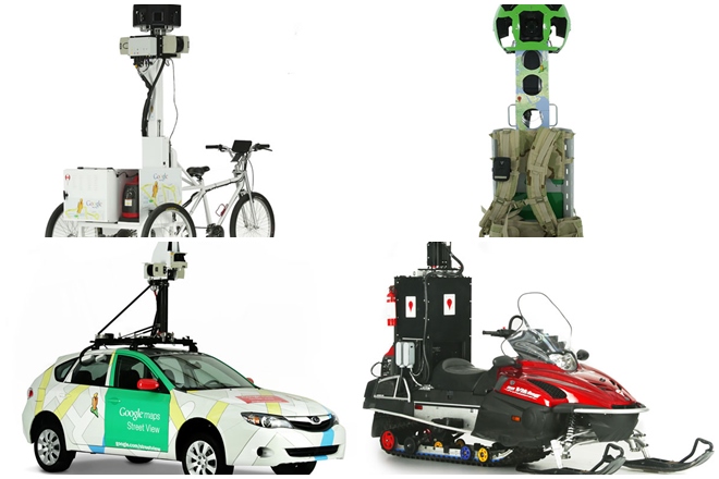 Google Street View devices. (Image: Google)
It has been extensively used in the United States, Canada and many European countries, its applications in India was initially permitted for a few locations.
What Google wanted to do in India with Street View:
The internet services giant wanted to cover most of the Indian territory through the Google Street View.
Google had on an experimental basis launched Street View in some of the tourist sites like Taj Mahal, Red Fort, Qutub Minar, Varanasi river bank, Nalanda University, Mysore Palace, Thanjavur temple Chinnaswamy stadium besides others in partnership with the Archaeological Society of India.
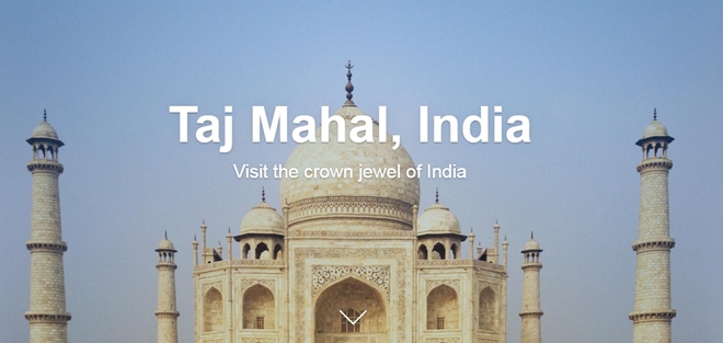 Google Street View project on Tak Mahal.(Image: Google)
Recent controversies on adoption of technology for maps:
In January this year, Google’s online maps showing Indian defence installations, nuclear power plants and other “sensitive” locations came under the scanner of Delhi High Court which asked the Centre to look into it and keep it informed on the issue. The concerns had come to fore after the Pathankot air base attack.
Adding to the list of technology adoption related controversies, the government has proposed the Geospatial Information Regulation Bill. According to the draft bill wrong depiction of India’s map could land the violators in jail with a maximum term of seven years and fine upto Rs 100 crore.
This measure has been envisaged by the government against the backdrop of instances where certain social networking sites showed Jammu and Kashmir and Arunachal Pradesh as part of Pakistan and China respectively. However, the proposal generated generated a furore, with many questioning its implementation.
(With inputs from PTI)
Source: financialexpress.com